When we go on a hike, we often take a picture. If we flew over a landscape, our “bird’s eye view” picture would capture a close representation of the natural pattern we see below. We use pictures to make maps to represent those natural patterns. Maps simplify that scene, and by using our ecosystem classifications to determine what is on the map, we explain what those patterns mean.
NatureServe ecologists use their expertise in ecosystem classification to support mapping landscapes from local protected areas, to watersheds, ecoregions, states, nations, and continents. These maps form the foundation for documenting natural patterns and current land use, assessing ecosystem health, and taking conservation action.
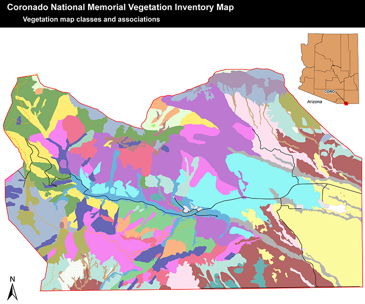
At local scales, we support the U.S. National Park Service Vegetation Mapping Inventory to describe and map vegetation in over 200 national park units using the US National Vegetation Classification. Each project involves sampling plants on the ground to describe all the vegetation types occurring within and around each park. Expert mappers then use aerial photographs to delineate patches and label each to their vegetation type. This labor-intensive process results in detailed maps of dozens of types in patches as small as ½ acre, like this one from Coronado National Memorial in Arizona. These maps form the basis for conservation and interpretation of park resources.
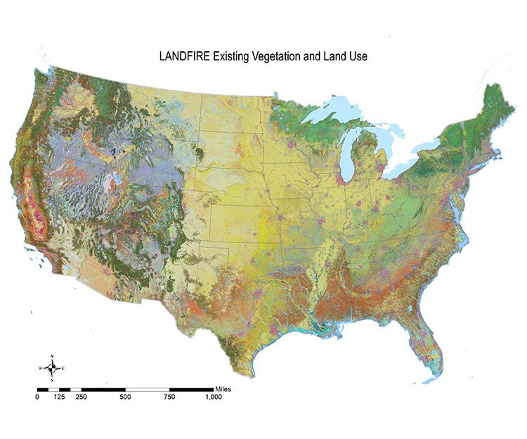
Since conserving biodiversity requires that we understand natural ecosystems across their entire distribution, we need to map ecosystems well beyond the borders of individual protected areas. In the United States, we serve on the map production team for the national inter-agency LANDFIRE program. Mapping hundreds of ecosystems nationwide involves using images taken from orbiting satellites. Over one million field observations of ecosystem types are used with environmental information, like landforms and soils, to map ecosystem types in patches of 5-10 acres across the entire country. These maps are refreshed periodically as fires, development, and other disturbances result in changes to the landscape. These maps are used on a daily basis nationwide in managing wildfire risk, natural resource management, and land use planning.