To understand how climate change will impact terrestrial natural resources in the National Capital Region, the National Park Service (NPS) partnered with experts at NatureServe to conduct climate change vulnerability assessments. These assessments provide park managers and visitors an understanding of how the climate is changing in the National Capital Region and which areas and ecosystems are most and least vulnerable. This information can support the development of meaningful natural resource management strategies and facilitate better communication of climate change vulnerability to park visitors.
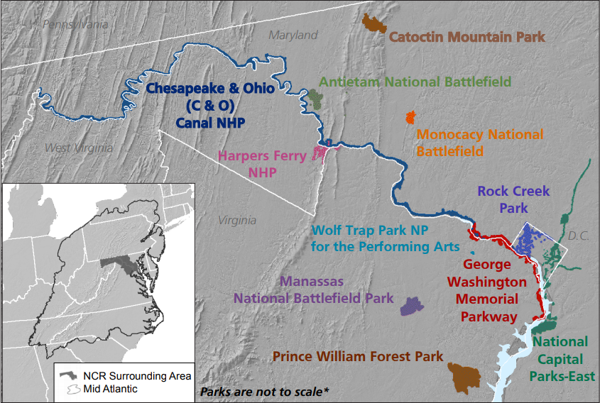
The links in the righthand menu provide access to resource briefs summarizing our findings for the region as a whole, and for each of 11 park units within it. To explore the results via interactive maps, visit the The NPS National Capital Region Enduring Features Map Gallery on Data Basin. For informative videos on the process behind this work, visit the Enduring Features project page on our website.