One primary way we conserve biodiversity is to identify and protect places encompassing the lands and waters needed for plant and animal communities to survive. “Protection” might involve acquiring rights to develop land or water, or it could involve forging partnerships with landowners to use land or water in ways that are compatible with the needs of biodiversity. Different approaches are used to identify these places. Some establish targets to represent the full spectrum natural diversity and vulnerable habitats across regions and continents while others might focus on those areas most essential to prevent habitat loss and extinction.
Place-based Conservation Targets
In 2010, the Parties to the Convention on Biological Diversity (CBD) adopted a strategic 10-year plan to catalyze national and international conservation efforts and reverse the planet’s staggering loss of biodiversity. It called for protecting 17% of each nations land area for biodiversity.
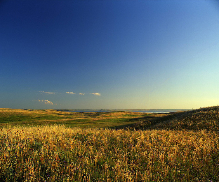
In 2017, with support from the North American Intergovernmental Committee on Cooperation for Wilderness and Protected Areas Conservation (NAWPA Committee), we completed an analysis that aimed to identify areas to represent grasslands ecosystem diversity across central North America from Canada through northern Mexico. These sites would collectively advance the CBD 17% target within these three countries.
We used our maps of major grasslands types along with measures of their natural condition, and locations of at-risk species, to propose 177 sites representing at least 17% of the historic extent of each grassland types. These large landscape sites – if targeted and secured for compatible land and water use – could secure the regions native grassland biodiversity. Click here to learn more.
Parties to the Convention on Biological Diversity (CBD), along with the Biden Administration, are now calling for “30 by 30” which increases the global conservation target from 17% to 30% by 2030. As with the NAWPA effort, NatureServe remains very well positioned to contribute critical biodiversity information toward identifying places to achieve the “30 by 30” target.
Key Biodiversity Areas
Key Biodiversity Areas (KBAs) are among the most unique and irreplaceable lands and waters on Earth for nature. From mountain tops to the depths of the ocean, these sites are essential to the persistence of the planet’s biodiversity.
An area qualifies as a Key Biodiversity Area because it harbors a large proportion of the global distribution of threatened or geographically-restricted biodiversity, is of extremely high ecological integrity, and/or supports essential ecological processes, like sites providing refuge for migratory species. We are currently supporting identification of KBAs across Canada.
The Key Biodiversity Area Partnership—an ambitious partnership of 13 global conservation organizations, including NatureServe—is helping prevent the rapid loss of biodiversity by identifying these places on the planet that are critical for the survival of unique plants and animals. By mapping these most important sites on Earth, and providing information about the wildlife living there, private industry, governments and other stakeholders can make the best decisions about how to manage that land (or waters), where to avoid development, and how to best protect the animals and plants for which the sites are so important.
Safeguarding sites does work—we have 40 years of case studies that illustrate the value of identifying and safeguarding biodiversity. To date, the partnership has mapped more than 16,000 KBAs worldwide, conserving important populations of more than 13,100 species.
Because KBAs offer one essential component for conserving and scaling up action for our planet’s biodiversity, they can help ensure that the next 10 years effort to achieve “30 by 30” includes sites most crucial for sustaining global biodiversity. They can also help target the best actions to prevent extinctions, improve the status of threatened species, and halt and reverse population declines of wildlife species and loss of intact and representative ecosystem types.
Read about Ghana’s Atewa Forest, a KBA that provides clean drinking water to more than 5 million Ghanaians, and how global companies joined forces with local groups to protect it.
Conservation Gap Analysis
Effective conservation design requires consideration of what has already been protected and what is most at risk. Gap analysis addresses this need by pinpointing “gaps” in existing conservation lands – places where biodiversity or critical ecosystem functions are not adequately protected and need our help most. Using NatureServe conservation status and distribution data, we identify which species and ecosystems are at-risk and not well represented within existing protected areas. We use this information to map priorities for biodiversity conservation, empowering the conservation community to act where it matters most.
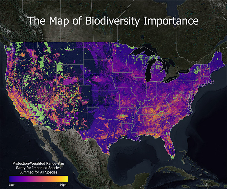
The Map of Biodiversity Importance
Through a landmark collaboration, NatureServe has released a portfolio of maps that identify areas critical to sustaining our nation's rich biodiversity.
Ecosystem Representation
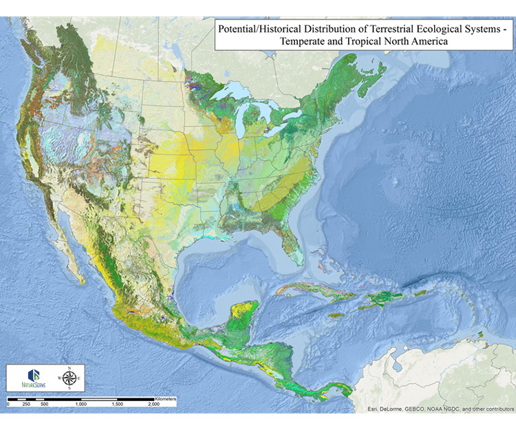
Documenting changes in ecosystem extent and protection is essential to understanding status of biodiversity and related ecosystem services. NatureServe developed both potential and historical vs. current distribution maps of upland and wetland ecosystem types for the temperate and tropical Americas.