NatureServe develops, maintains, and shares a wide range of information on imperiled species and ecosystems, often in collaboration with members of the NatureServe Network. Please visit our Access Data on Species & Ecosystems page for the latest list of information products that we have available.
Many of our resources are free to help advance conservation awareness and decision-making. For more specialized needs, such as detailed spatial datasets or custom analyses, we offer licensed data and scientific consulting. Fees cover staff time and help sustain our mission. This page summarizes our data use terms and citation requirements for open and licensed data and tools.
Open Data Terms of Use
NatureServe publishes open data through open licenses under the following conditions.
NatureServe Explorer
CC BY. This license enables reusers to distribute, remix, adapt, and build upon the material in any medium or format, so long as attribution is given to the creator. The license allows for commercial use. CC BY includes the following elements:

BY: credit must be given to the creator.

Public-level Data accessed through NatureServe Explorer Pro
CC BY-NC. This license enables reusers to distribute, remix, adapt, and build upon the material in any medium or format for noncommercial purposes only, and only so long as attribution is given to the creator. CC BY-NC includes the following elements:
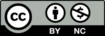
BY: credit must be given to the creator.

NC: Only noncommercial uses of the work are permitted.
Biodiversity maps published through NatureServe’s Open Data Portal
CC BY-NC. This license enables reusers to distribute, remix, adapt, and build upon the material in any medium or format for noncommercial purposes only, and only so long as attribution is given to the creator. CC BY-NC includes the following elements:
BY: credit must be given to the creator.
NC: Only noncommercial uses of the work are permitted.
Open Data Citation
Any external products developed using NatureServe’s open data should include one of the following citations:
For public-scale data obtained through NatureServe Explorer:
NatureServe. YYYY. NatureServe Explorer [web application]. NatureServe, Arlington, Virginia. Available https://explorer.natureserve.org/pro/. (Accessed: Month DD, YYYY).
For public-scale data obtained through NatureServe Explorer Pro:
NatureServe. YYYY. NatureServe Network Biodiversity Location Data accessed through NatureServe Explorer Pro [web application]. NatureServe, Arlington, Virginia. Available https://explorer.natureserve.org/pro/. (Accessed: Month DD, YYYY).
For data received outside of NatureServe Explorer or NatureServe Explorer Pro, including biodiversity maps from NatureServe’s Open Data Portal:
NatureServe. [YYYY]. [Name of Data Product]. NatureServe, Arlington, Virginia. NatureServe. YYYY.
Licensed Data Terms of Use
License agreements are required for commercial use of select biodiversity mapping resources, high-precision documented and predicted locations of at-risk species, and area of interest reports accessed through InSite by NatureServe.
If you are interested in licensing data, submit a custom data request.
NatureServe's Rights
NatureServe shall retain ownership of all materials or intellectual property developed by NatureServe as of the date these data were accessed, including, without limitation, all NatureServe trademarks, patents, copyrights, trade secrets, know-how, materials, standards, brochures, logos, or other intellectual property or proprietary rights, and all rights, title, and interest in and to data. No interest whatsoever is conveyed to a user of the data in right, title, and interest.
Warranty
NatureServe provides this website, data and other materials hereunder “as is” and hereby disclaims any and all warranties, express or implied, including, without limitation, all implied or statutory warranties of merchantability, fitness for a particular purpose, accuracy of informational content, and non-infringement. NatureServe makes no warranty or representation of any kind, express or implied, with respect to the quality, originality, suitability, or searchability of the data including, without limitation, technical inaccuracies and typographical errors. NatureServe disclaims all responsibility for any loss, injury, claim, liability, or damage of any kind resulting from use of the data.
NatureServe’s aggregated data should not be regarded as a substitute for on-site surveys required for environmental assessments. If ground-disturbing activities are proposed on a site, the appropriate NatureServe Network Program should be contacted for a site-specific review of the project area. For contact information, go to the NatureServe Network Directory at: https://www.natureserve.org/ns-network-directory. NatureServe Network Programs are located in each U.S. and Canadian jurisdiction (states, provinces, territories, and the Navajo Nation), and employ staff that have expertise on the status and location of imperiled species and ecosystems occurring in their local jurisdiction. In addition, these NatureServe Network Programs may have other data resources not available in the data provided by NatureServe (e.g., migratory routes, observations for wide-ranging and widely distributed species, etc.), therefore NatureServe strongly recommends consulting with contributing NatureServe Network Programs when making conservation management decisions, especially when they impact species or habitats at a local site.
For information on NatureServe’s Network data use, see Acceptable Uses of Network Data.