Healthy natural ecosystems are essential to conserving biodiversity and providing ecosystem services to society. Ecosystem assessment takes many forms, but most commonly it involves documenting factors that affect the health and functioning of natural ecosystems. This could include documenting how much of an ecosystem type has been converted to intensive land uses; like for agriculture or urban development. It could involve documenting patterns of natural habitat fragmentation which inhibits the movement of species across natural landscapes. Assessment could center on certain ecosystem threats, such as the spread of invasive and exotic species that displace native species. Ecosystem assessment can also address all these different facets within a given region or landscape in order to prioritize conservation actions that will improve ecosystem health.
Landscape Condition is a term we use for predicting the likely natural condition one will encounter in the field by mapping land uses in the surrounding landscape. Typically, native species respond negatively to human development and so the location and relative intensity of land uses can tell us much about what we can expect to encounter on the ground. We maintain these types of maps across all places where we work so that they can be used in all forms of ecosystem assessment.
Invasive Species are commonly introduced through economic activity. Many species arriving in North America from around the world have no natural predators here and so they can easily displace native species and dramatically alter natural ecosystem function. Any large-scale effort to protect biodiversity and the environment must be able to deal with the effects of invasive species. Early detection is often the key to successful eradication. iMapInvasives is a cloud-based application for tracking and managing invasive species. Developed by NatureServe and partners in the iMapInvasives Network, it gives resource managers the power to know about the latest observations of an invasive species, in real-time, so they can respond to new threats to the ecosystems they manage.
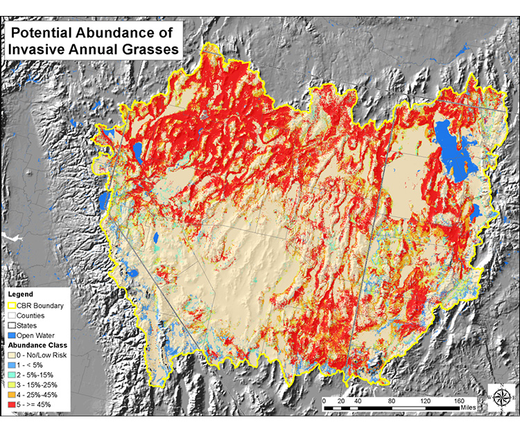
Also, invasive annual grasses, primarily cheatgrass (or Bromus tectorum), are a severe risk to native vegetation of the intermountain West. Once established, annual grasses alter natural fire regimes and outcompete natives until, in some places, they become the overwhelming dominant. We design regional spatial models to indicate the relative abundance of invasive annual grass at five levels of canopy cover.
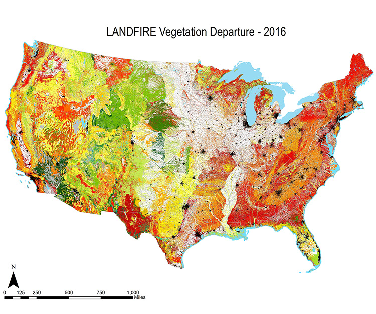
Many ecosystems across North America function with a natural cycle of wildfire, where periodic fires remove plant materials and open shady tree canopies to facilitate plant regeneration. For example, within a given forested landscape, you should expect to see some patches of young, intermediate, and old age. However, over the past century, the suppression of wildfire has disrupted those natural cycles and resulted in unhealthy ecosystems where dense trees have crowded some species out of existence. In open shrubland ecosystems, invasive introduced “fine-fuel” and brought more frequent fires. These accumulated conditions combine with emerging climate change stress to cause the unprecedented size, intensity, and destructive wildfires of recent years. Vegetation Condition Departure is a measurement used to describe current conditions relative to their expected conditions under their natural fire cycle. In our partnership with the inter-agency LANDFIRE effort, we help to produce and apply models and maps to document the current status of wildfire regimes in North American ecosystems.
Rapid Ecoregional assessment – The Bureau of Land Management implements Rapid Ecoregional Assessments (REAs) to identify important resource values and patterns of environmental change that may not be evident when managing smaller, local land areas. REAs look across all lands in an ecoregion to identify regionally important habitats for fish, wildlife, and species of concern. REAs then gauge the potential of these habitats to be affected by four overarching environmental change agents: climate change, wildfires, invasive species, and development (both energy development and urban growth). NatureServe led REAs in four ecoregions that encompass the heart of BLM lands across the west, including the Central Basin and Range, Mojave Basin and Range, Madrean Archipelago, and Seward Peninsula.
Ecological Integrity Assessment
Checking the Pulse of an Ecosystem
Ecological Integrity Assessments provide a standard “biophysical exam” that assesses how well an ecosystem is doing, including its component vegetation, soil and hydrology, as well as its size and interactions with the surrounding landscape. We use a three-level approach to assess ecological integrity, from remote sensing imagery, to rapid field assessments and detailed quantitative assessments.
Ecological Integrity Assessment models provide land managers, conservationists, and agencies with critical information on factors that may be degrading, maintaining or helping to restore an ecosystem. The models also guide assessment of element occurrences for Heritage Methodology.
Value
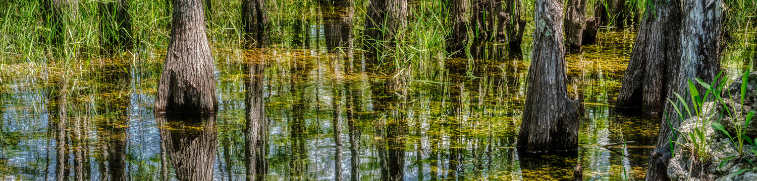
Determining the integrity of a particular occurrence of a ecosystem is a critical aspect of targeting conservation of ecosystems, ensuring that the best remaining examples are identified, and setting thresholds by which ecosystem collapse can be judged. NatureServe and its member Natural Heritage Programs have developed a rigorous and consistent method for evaluating ecological integrity, especially for wetlands.
Many ecosystem monitoring and assessment programs are expanding their focus to address changes in ecosystem condition, in addition to changes in acreage. Our multi-metric assessment method can be effectively used in the field and with remote sensing imagery to measure condition using an index of ecological integrity, in a practical, repeatable manner.
Features & Benefits
We developed our ecosystem condition assessment for all terrestrial ecosystems using the concept of ecological integrity. Building on the related concepts of biological integrity and ecological health, ecological integrity can be defined as “an assessment of the structure, composition, and function of an ecosystem as compared to reference ecosystems operating within the bounds of natural or historic disturbance regimes.” This broad definition can serve as a guide to developing ecological integrity assessment methods that are distinct from related assessment methods for ecological functions or ecosystem services.
Our multi-metric approach for our Ecological Integrity Assessment (EIA) method is similar to the Index of Biotic Integrity (IBI) for aquatic systems. Our method builds on the work of other rapid assessment methods (especially the Ohio Rapid Assessment Method and California Rapid Assessment Method), and our previous work on standardized methods for assessing ecosystem condition for the Natural Heritage Network, along with setting performance standards for wetland mitigation.
Critical to our effort was the use of conceptual models that highlight ecological factors and attributes for which metrics (or specific indicators) of integrity are most needed. We defined metrics as values derived from specific measures (e.g., basal area, stand structural class, species diversity) that inform us about the status of an ecological factor or attribute of integrity.
For our model, the primary rank factors and major ecological factors are landscape context (landscape, buffer), size, and condition (vegetation, soils, and hydrology). We then select key metrics that are most responsive, practical, cost-effective and well-tested in measuring the condition of the ecosystem. The conceptual model also provides a structure in which to identify known stressors, or agents of change, that affect these major ecological factors. Together they can help guide management decisions to maintain or restore ecological integrity.
The method has great value for the Natural Heritage Network, contributing to a consistent evaluation of reference sites and the potential for establishing a network of reference standard (minimally disturbed) sites within and across jurisdictions. It can be a component of inventory and ambient monitoring of ecosystem condition, and it helps set ecological performance standards to assess site-specific and watershed-scale mitigation and restoration projects. The approach is also used by the National Park Service to provide service-wide products that improve management of biological resources in national parks, and maintain a broad ecosystem-based framework for park management.
Learn More
Additional Resources
Related Publications
- The Ecological Integrity Assessment Framework: A Framework for Assessing the Ecological Integrity of Biological and Ecological Resources of the National Park System (Version 1.1)
- Getting the Message Across: Using Ecological Integrity to Communicate with Resource Managers
- Great Basin National Park: Natural Resource Condition Assessment
- User Guide for Wetland Assessment and Monitoring in Natural Resource Damage Assessment and Restoration
- Monitoring and Evaluating the Ecological Integrity of Forest Ecosystems
- Modeling Invasive Annual Grass Abundance in the Cold Desert Ecoregions of the Interior Western United States
- Rapid Ecological Integrity Assessment Metrics to Restore Wildlife Habitat and Biodiversity for Shortleaf Pine–Oak Ecosystems